Turning storm recovery into a classroom: IU Northwest course focuses on conservation
- By: Indiana University Northwest
- Last Updated: October 14, 2026





First-year seminar uses hands-on GIS technology to assess damage from August storms
Occasional thunderstorms are common in Northwest Indiana, but when a large storm system blew into the region on Aug. 11, 2026, it brought extreme winds, tornadoes, hail, and flooding.
As a result, many Northwest Indiana residents went without power — some for weeks — and the storm caused significant damage across the region. The Indiana University Northwest campus wasn’t spared. Downed trees and broken branches littered campus as the fall semester was about to start.
With this as the backdrop, Joe Blockland’s first-year seminar couldn’t have come at a better time. The IU Northwest geosciences instructor had already planned an on-campus tree inventory with his students, which is now more important because of the widespread damage.
“At first glance, many of the trees appear healthy, but signs of storm damage are certainly present,” he said. “One of the very first trees we evaluated showed visible damage.”
That damage isn’t just an eyesore. Lucas Bartochowski, an environmental science major taking the course, said the damage can seriously impact public safety.
Learn about IU Northwest’s environmental science program
“We’ve got whole limbs that are snapped and splintering,” he said. “So, we’re flagging trees that might be at risk to things like power lines over the roads. The last thing we need right now is another power outage.”
Taking tree inventory isn’t just about keeping campus safe. The project aims to bring additional benefits to the community, such as increased biodiversity.
“A big thing is making sure there are different kinds of trees,” Bartochowski said. “You’re more at risk for having an issue with one type of tree than if you have multiple spread out. It’s been helpful for my outlook on how the ecosystem interacts.”
Bartochowski is getting hands-on experience with environmental conservation, a field he wants to work in. Through this tree inventory, he’s had the chance to work with actual data and systems he might see in the workplace.
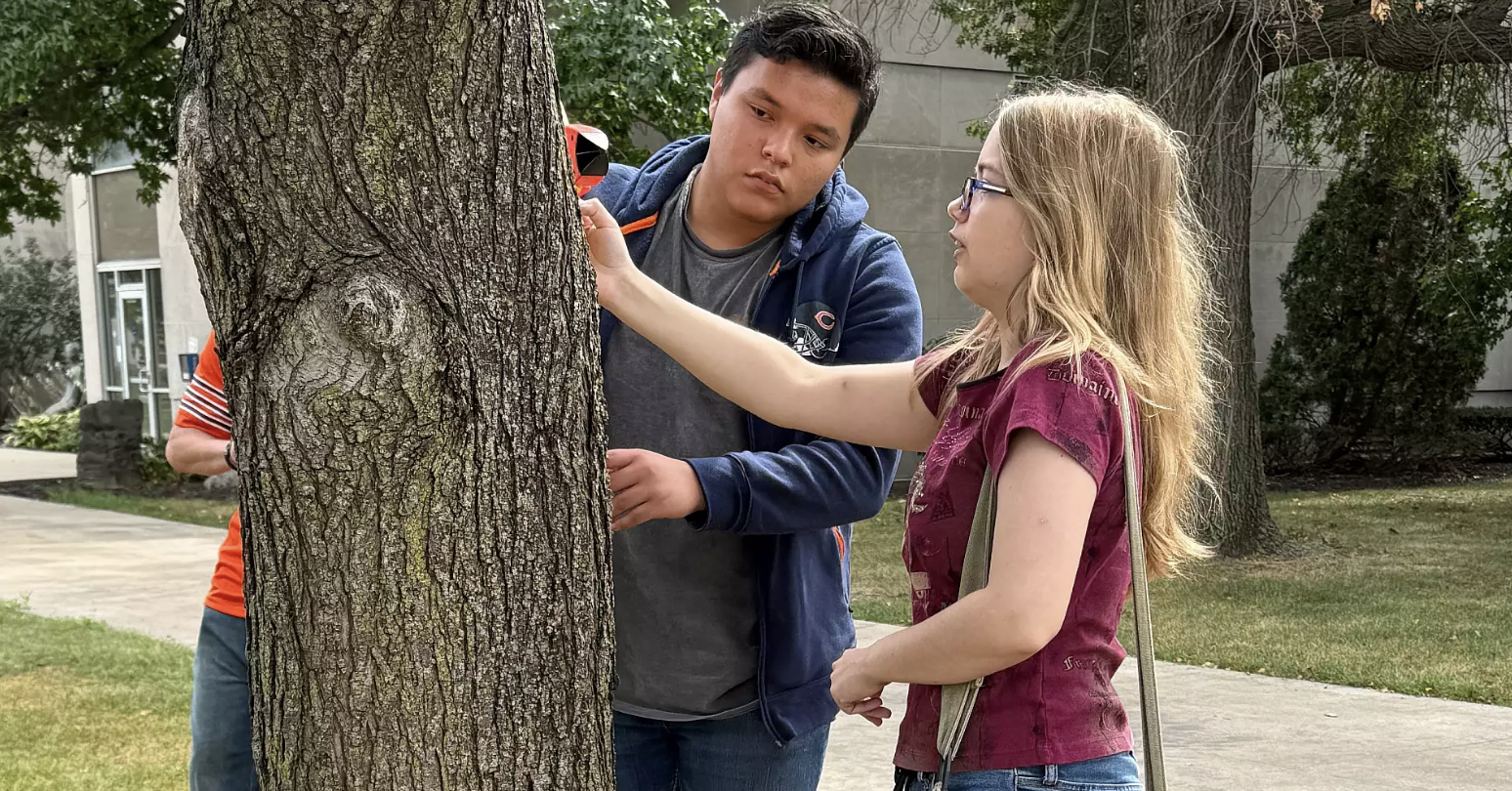
Blockland’s students are using real-world technology to take measurements, identify species and flag potential problems.
“A modern tree inventory is centered around Geographic Information Systems (GIS), which is essentially a database management system and a map-making software suite,” Blockland said. “Students use a laser range finder to calculate the height of trees and branches and a tape measure to measure the diameter of tree trunks. They use their phones to send data to the Geographic Information System (GIS) through a custom-built app.”
This technology has applications beyond just trees. The same tools are used to track power outages, identify food deserts and map out public infrastructure.
For now, the class is using GIS to support IU Northwest’s Tree Campus Higher Education designation – a national recognition awarded by the Arbor Day Foundation honoring universities dedicated to urban forestry.
“To earn and keep it, a campus must meet several standards such as establishing a tree advisory committee and sponsoring a student service-learning project,” Blockland said.
While any recommendations for tree planting would need to be discussed with other campus leaders, Blockland is interested in planting more diverse, native trees as well as species that are more resilient to storm damage.
Being a Tree Campus is about demonstrating a commitment to environmental leadership and a greener future, but Blockland also hopes the project will spark curiosity in his students.
“By centering coursework on our community, students see the real-world, local impact of their work, and it helps connect them to the campus,” he said. “It can inspire an undeclared student to declare a minor, prepare them for upper-level GIS classes and boost their resume. Just as importantly, it introduces real environmental challenges — like storm recovery and urban tree management.”
Bartochowski, for one, is excited to use the skills he’s learning in future courses. He plans to earn the new GIS certificate, and he sees this experience paving the way for his future career.
“I want to go into conservation and restoration, so part of that is identifying damage and finding invasive species. This has been a precursor for what I want to do later,” he said. “There aren’t enough people focused on the Northwest Indiana region, which is why I want to do it here.”
This first-year seminar is only the beginning for Bartochowski, and Blockland will continue to focus on active, place-based learning. Even in the wake of a major storm that uprooted trees and left thousands in the dark, this tree inventory shows that conservation and restoration are still happening. And there’s always the potential to plant the seeds of a better future.
